
Types
Categories
Cities
Areas
States
We found 5cc 0 results.
List View
Map View
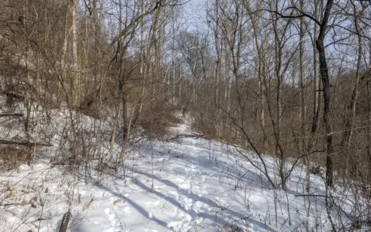
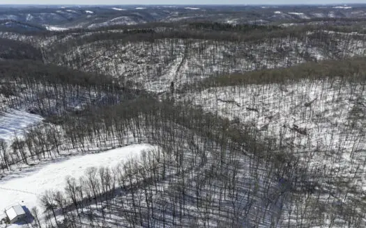
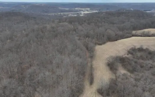
Tract 11- With road frontage allowing for potential split
$1
Tract 11: 75 +/- acres Malaga Township Miltonsburg-Calais Rd GPS Coordinates 39.839667, -81.209671 Parcel 12-005011-0000 Parcel12-005012-0000 Parcel 12-006008-0000 Parcel 12-006012-0000 75± ...
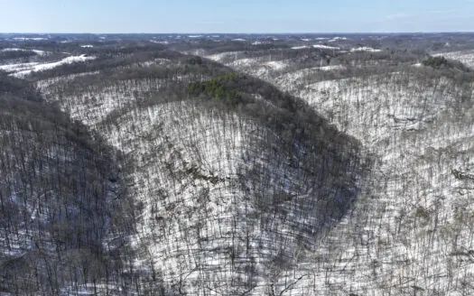
Tract 5 160± Acres | Premier Hunting Land | Monroe County, Ohio
$1
Tract 5: 173+/- acres Graysville and Perry Townships Mann Rd GPS Coordinates 39.664312, -81.145098Parcel 16-012005-0000Parcel 29-005010-0000 Parcel 29-005012-0000Tract 5 - 160± Acres | Prem ...
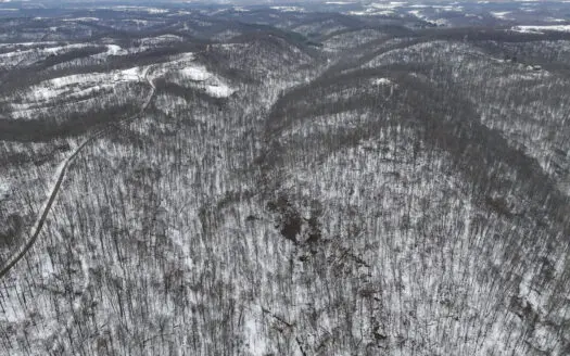
Tract 16 Washington County Large Acreage Hunting and Timber
$1
Tract 16: 206+/- acres Wesley and Decatur Townships C59 or Big Run Rd GPS coordinates 39.360136, -81.828455 Parcel 090040692000 Parcel 400084556000 Parcel 400084560000 206± Acres | With a ne ...
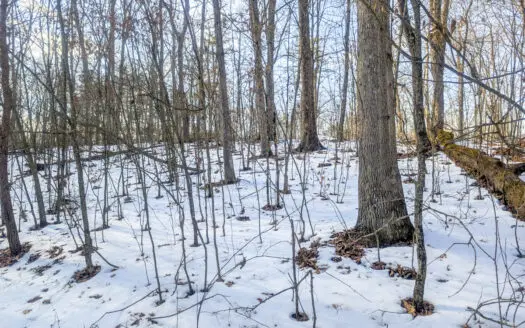
Tract 8 Dead End Road Old Homestead with Hunting and Timberland
$1
Tract 8: 202+/- acres Wayne and Summit Townships 44955 Township Rd 272 GPS Coordinates 39.749019, -81.187776Parcel 22-025001-1000Parcel 32-003004-1000 Parcel 22-025001-2000Tract 8 202± | Loc ...

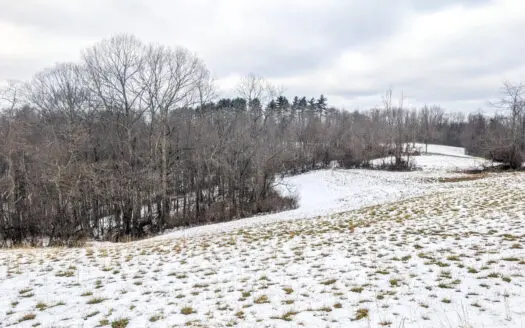
Tract 2 33 +/- Acres Monroe County Hunting Land
$1
Tract 2: 33+/- acres Center TownshipMorris Ridge Rd GPS Coordinates 39.792559, -81.115194 Parcel 04-008014-000033+/- Acres Monroe County Property. Hilly terrain on the narrow part of the acr ...
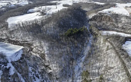
Noble County Hunting and Timber Tract 13
$1
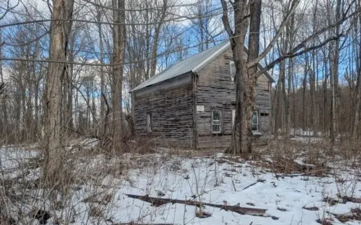
GPS Coordinates 39.664867, -81.292338Parcel 10-0021289.000 Parcel 10-0021293.000 Parcel 10-0050485.000 Tract 13 – This old home site along the road with split potential along both sides of t ...
Tract 13 – This old home site along the road with split potential
$1
Tract 13: 135 +/- acres Elk Township Ayers Ridge Rd GPS Coordinates 39.664867, -81.292338 Parcel 10-0021289.000 Parcel 10-0021293.000 Parcel 10-0050485.000 135± Acres | This old home site al ...
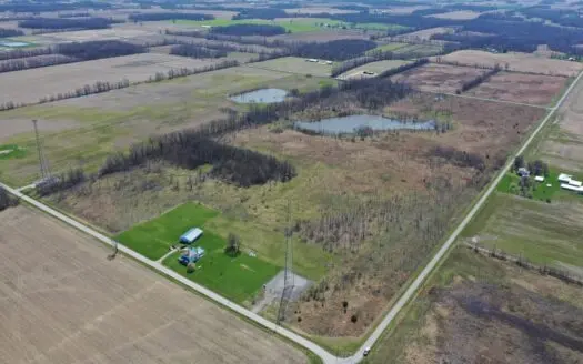
Smaller Monroe County Recreational Tract 9
$1
GPS Coordinates 39.750413, -81.190022Parcel 22-019001-0000 Parcel 22-020003-0000Tract 9- Located on two sides of a dead end road, this property offers a great potential build site. An oil dr ...
Tract 7 Timberland Property bordering Wayne National Forest
$1
Tract 7: 53+/- acres Wayne Township 35121 Edwina Rd, Woodsfield, OH 43793 GPS Coordinates 39.723525, -81.187060 Parcel 32-009002-1000 Tract 7 - 53± - Ridge tops to swamp bottoms this tract o ...

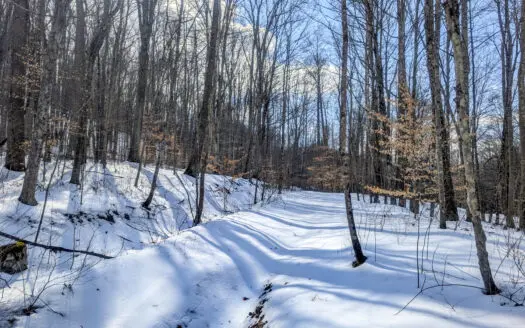
Tract 10- Gently rolling hillsides back a dead end road
$1
Tract 10: 93+/- acres Summit Township Township Rd 55 GPS Coordinates 39.794641, -81.200080 Parcel 22-008003-0000 93± Acres | Gently rolling hillsides back a dead end road opens up to a poten ...
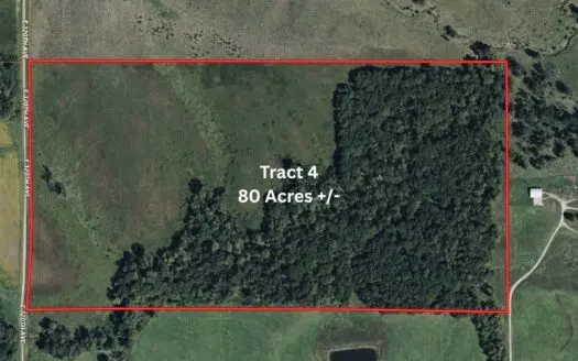
Tract 4 Prime Hunting & Recreational Land in Monroe County
$1
Tract 4: 75 +/- acres Center Township Township RD 626GPS Coordinates 39.695606, -81.119352Parcel 04-047001-0000 Parcel 04-047008-0000Tract 4 - 75± Acres – Prime Hunting & Recreational Land i ...
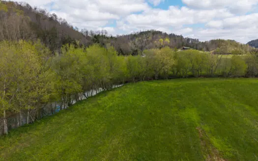
Tract 15 Beaver Pond and Hunting Beauty in Washington County
$1
Tract 15: 133 +/- acres Salem and Aurelius Townships Peaker Run Rd GPS coordinates 39.583987, -81.412264 Parcel 030006960000 Parcel 320054532000 133 ± Acres | Few properties offer what this ...
Outdoorsman Dream Noble County Timberland Tract 12
$1
GPS Coordinates 39.762992, -81.328853Parcel 34-0021448.000 Parcel 34-0021449.000 Parcel 34-0021452.000 Tract 12- Few properties come along that check all the boxes for a true outdoor enthusi ...
Auction Extravaganza: Secluded 200 Acres in Hawkins Co. TN
$1
Auction Extravaganza: Secluded 200 Acres in Hawkins County, Tennessee Nestled within the serene embrace of the idyllic Eidson Community in Hawkins County, Tennessee, lies a hidden gem—a sp ...
Tract 12- Outdoorsman Dream Hunting Property
$1
Tract 12: 246+/- acres Stock Township Buckingham Rd GPS Coordinates 39.762992, -81.328853 Parcel 34-0021448.000 Parcel 34-0021449.000 Parcel 34-0021452.000 246 ± Acres | Few properties come ...
Monroe County OH 33 +/- Acres Woodsfield, OH
GPS Coordinates 39.792559, -81.115194Parcel 04-008014-0000 Tract 2 33.35 Acres of Hunting Land, Timber, Creek. Nice size Trees on the property. NE side of property borders Sunfish Creek. C ...
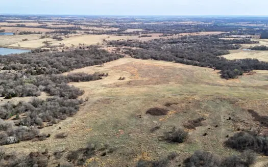
Blanchard Dibble McClain County Oklahoma Land For Sale Hunting
AUCTION: 250± ACRESTUESDAY, APRIL 21 | 10 AMDon’t miss this opportunity to purchase 250± acres in McClain County, Oklahoma, located just outside of Dibble. Held in the same family ownership ...
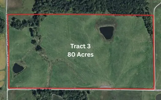
PLH Family Limited Partnership- TRACT 3
Tract 3 is an exceptional 80 acre m/l grass farm. It has gravel road frontage on two sides and is located near the Wayne Helton Memorial Wildlife Area. Tract 3 has 2 nice ponds. The East pon ...
Secluded Hunting and Timber Tract in Noble County Tract 14
GPS Coordinates 39.762992, -81.328853Parcel 34-0021448.000 Parcel 34-0021449.000 Parcel 34-0021452.000 Tract 14- This secluded property offers great recreational and timber investment potent ...
Emptage Land Auction – Hunting Land
EMPTAGE LAND AUCTION Sat., May 2 @ 10AM SHARP Auction @ 227 W. Wyandot Ave., Upper Sandusky, Ohio United Country Walton Realty & Auction Co., LLC Office Selling 75 Acres +/- * 2 Tracts * C ...
Farmhouse, Fields, and Freedom – Own It All at Auction East TN
An Exceptional East Tennessee Land Auction Opportunity! Located at 512 Highway 70 in Kyles Ford, Tennessee. This 268.53-acre property will be sold at Absolute Auction—to the Highest Bidder, ...
Belmont County Recreational Land Tract 17
GPS Coordinates 39.875786, -80.943583Parcel 43-00737.000 Tract 17- Located in Belmont County, this property offers big pine forests on the tops of ridges with hardwoods located along the edg ...
PLH Family Limited Partnership- TRACT 4
Tract 4 is an 80-acre grass farm/timber tract. Approximately 35 acres of Tract 4 is open pasture ground. Nearly all the remainder of Tract 4 is timber. Located near the Wayne Helton Memorial ...
Acreage for Sale on Little Reed Island Creek
Acreage for Sale on Little Reed Island Creek Discover this +/-177.5 acre wooded property with extensive frontage along Little Reed Island Creek. Featuring approximately 1.7 miles of creek fr ...
Listings
Map View